
Blog
Weather
Beryl
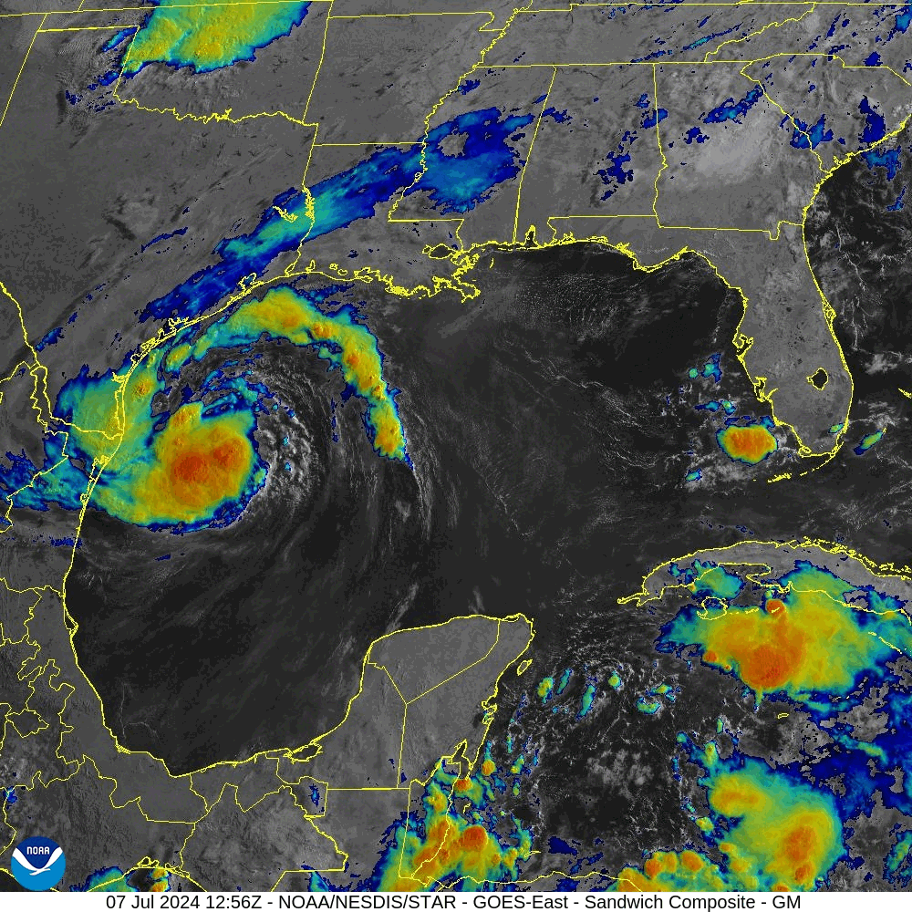
Beryl is forecast to make landfall in the vicinity of Matagorda Bay, TX on Monday 08 July as, possibly, a category 2 hurricane.
Beryl has become better organized this morning. Satellite images show deep convection becoming more symmetric around the center, and Brownsville radar has been showing an eyewall forming, although still open on the northwest side. An Air Force Reserve Hurricane Hunter aircraft recently reported maximum flight-level winds of 62 kt with the central pressure falling to 992 mb, so the initial wind speed is raised to 55 kt. Further intensification is likely as Beryl moves over very warm waters within light shear conditions. Rapid intensification is a distinct possibility if the core can become isolated from the dry air that has been inhibiting intensification during the last day or so. While there are no changes to the intensity forecast based on the latest guidance, we are expecting Beryl to be intensifying up until landfall early Monday, and people should be preparing for the possibility of a category 2 hurricane landfall.
NWS/NHC 1000 AM CDT Sun Jul 07 2024
Y’all out there in Texas, stay safe!
Semper Paratus,
/fl
Weather
Hurricane Beryl
Hurricane Beryl sweeps into the Caribbean as a Category 4 hurricane.
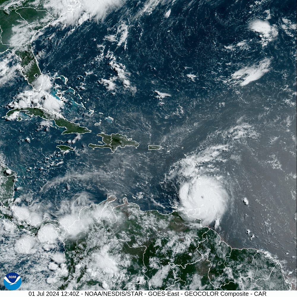
Hurricane BERYL
Location: 12.8°N 62.3°W
Maximum Winds: 130 kt
Minimum Central Pressure: 946 mb
Radius of Maximum wind: 10 nm
At this time, it appears to be no threat to the mainland U.S., but we’ll be keeping a watch on it, and praying for the people in its path.
It is still early in the season, and there is more brewing…
/fl