
Blog
Weather
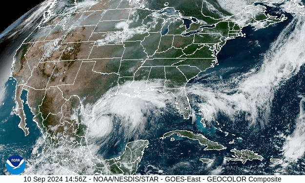
Hurricane Helene
The hurricane has intensified by 30 kt since sunrise and given the conducive environmental conditions and contracting inner core, it seems likely that Helene will be at or very near category 4 strength when it makes landfall in the Florida Big Bend this evening.
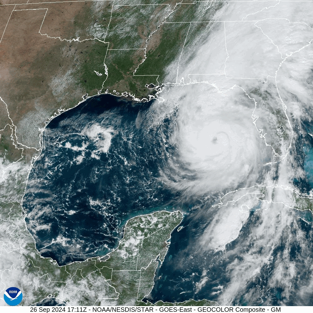
A BIG storm…
/fl
Weather
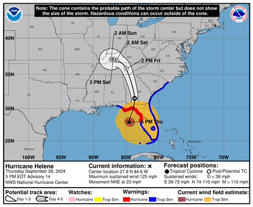
Tropical Storm Helene
Tropical Storm Helene, soon to become Hurricane Helene, is still forecast to make landfall in the Big Bend area of Florida around 2000 Thursday. The storm (ie. stormspeed) is forecast to move relatively rapidly and the windspeed at landfall is forecast to be around 115 MPH. We’ll soon see if the predictions are correct.
S: Tropical Storm – wind speed between 39 MPH and 73 MPH
H: Hurricane – wind speed between 74 MPH and 110 MPH
M: Major Hurricane – wind speed greater than 110 MPH
Stay safe.
/fl
Weather
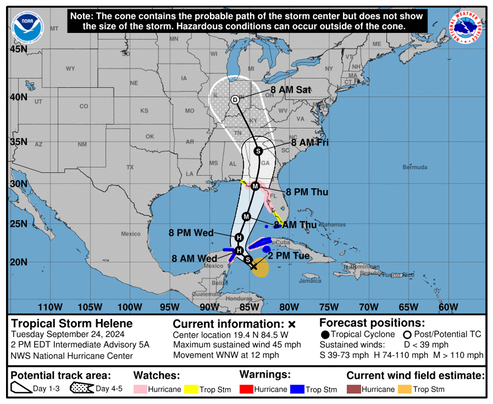
Tropical Depression Nine (TD-9)
We have been watching the genesis of a tropical low located in the western Caribbean. The consensus of the forecast model’s indicate that it is headed for the Big Bend area, and will likely reach Category 2-3 strength before making landfall sometime Thursday.
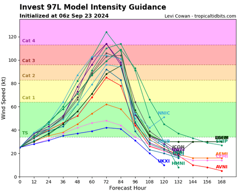
Stay safe…
/fl
Weather
Remembering Hurricane Ivan
Today is the 20th anniversary of 2004 Hurricane Ivan—"the most destructive hurricane to affect this area in more than 100 years." A major event that wrecked the Gulf coast from Mississippi to Panama City.
Being in the near Northeastern quadrant of the storm, we were hit especially hard by the wind, the tidal surge, and several of the (estimated) 117 tornados spawned by the storm.
/fl
Weather
Francine
The latest forecast has Tropical Storm Francine headed for the Louisiana coast. We are already experiencing some of the effects of the system here in Pensacola in the form of overcast and drizzle.

Francine is expected to bring heavy rainfall and the risk of considerable flash and urban flooding for far northeast Mexico into the far southern coast of Texas today and across much of Louisiana and Mississippi through Thursday. Flash and urban flooding is probable across the Mid-South Wednesday night into Friday morning.
FORECAST POSITIONS AND MAX WINDS INIT
10/1500Z 24.9N 95.6W 55 KT 65 MPH
12H 11/0000Z 26.0N 94.8W 65 KT 75 MPH
24H 11/1200Z 27.8N 93.2W 80 KT 90 MPH
36H 12/0000Z 29.9N 91.3W 75 KT 85 MPH…INLAND
48H 12/1200Z 32.2N 90.4W 40 KT 45 MPH…INLAND
60H 13/0000Z 34.6N 90.1W 30 KT 35 MPH…INLAND
72H 13/1200Z 35.8N 90.1W 25 KT 30 MPH...POST-TROP/REMNT LOW
96H 14/1200Z 37.0N 90.0W 20 KT 25 MPH...POST-TROP/REMNT LOW
120H 15/1200Z…DISSIPATED
NOAA
Stay safe.
/fl
Weather
Weather Makers
Here we are, in the "kinetic half" of our 2024 tropical-storm season. and so far it’s been fairly quiet. But, the barograph has been showing a downward trend, with surface low-pressure encroaching over the western Gulf of Mexico and Bay of Campeche. The surface model’s are starting to show (forecast) some storm activity in that region, moving NNE in the vicinity of Port Arthur, TX, and we may see some foul weather here as a result next week. This time of year, things can change rapidly.
Watching.
/fl