
Invest 96E has become "Raymond"
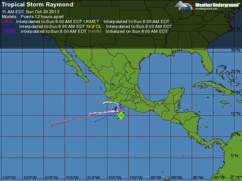
For the moment, Raymond has decided to meander West and stay in the Pacific instead of coming East toward the Gulf of Mexico.
Raymond has become better organized over the past few hours. Infrared satellite imagery shows an increase in deep convection near the center...and a 1018 UTC trmm pass showed signs of an inner core beginning to develop. The initial intensity has been raised to 45 kt based on the latest Dvorak estimate from SAB. An environment of warm water and low shear appears conducive for strengthening during the next couple of days. Later in the period...some southwesterly wind shear may result in a little weakening...but Raymond is expected to remain a hurricane through the end of the forecast period...
Raymond is expected to move slowly northwestward and then turn northward or even a little east of due north. After the trough lifts out... steering currents will remain weak on days 2 and 3...with a slow and erratic motion likely during this time. Late in the period...a mid-level ridge will build north and northeast of Raymond...which should impart a steadier westward or west-southwestward motion away from the coast. While the guidance is in general agreement on this overall scenario...there are considerable detail differences in the track of Raymond...especially how close it will get to the coast of Mexico...
[I]t is likely that there will be a hurricane meandering near the coast of south-central Mexico for the next several days.
Heavy rainfall from this system will likely spread northward into south-central Mexico during the next several days...and these rains could cause life-threatening flash floods and mud slides.