
Genesis of 99L
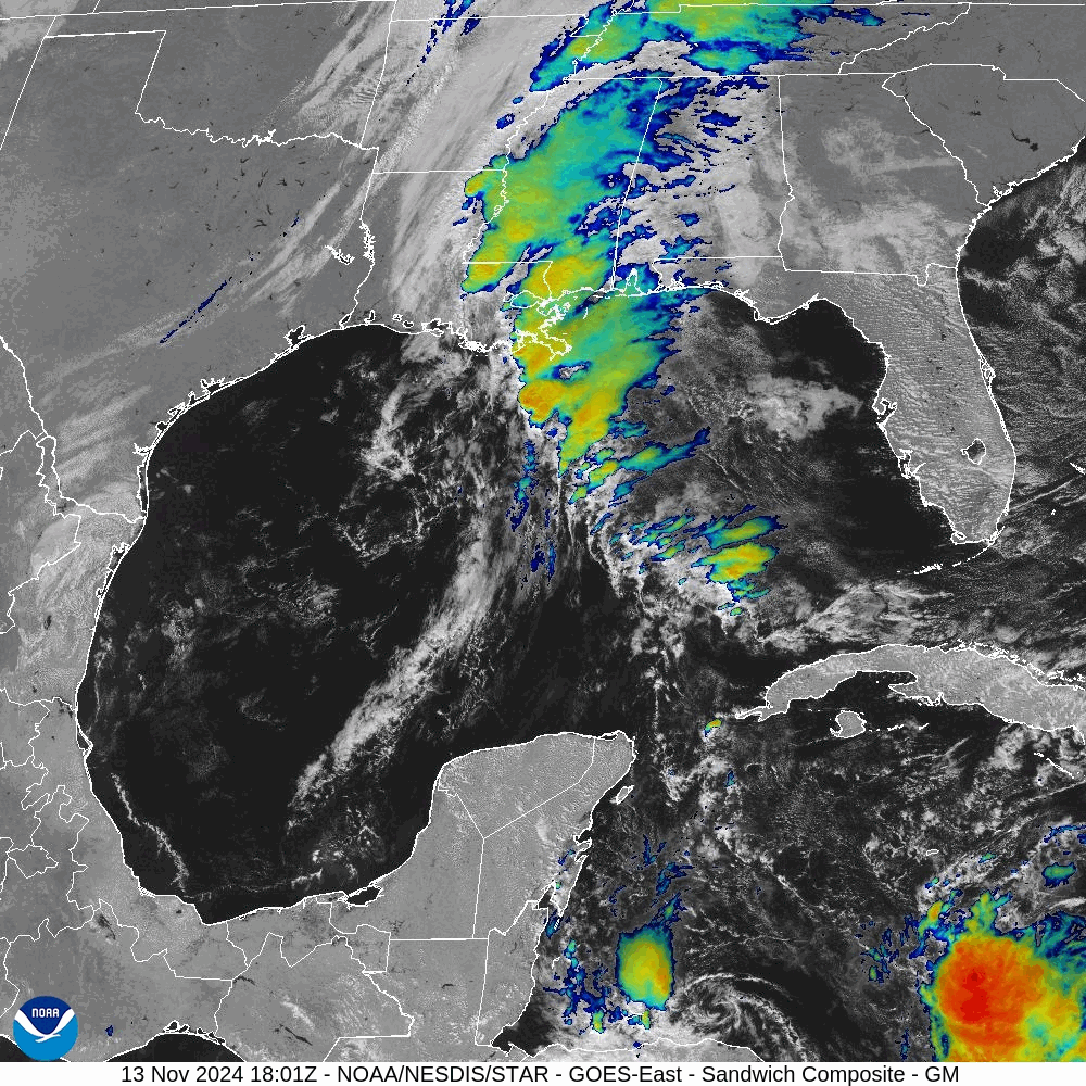
The tropical system labeled 99L can be seen forming in the lower right of this satellite photo-series; the CCW banding is clearly visible in the following image:
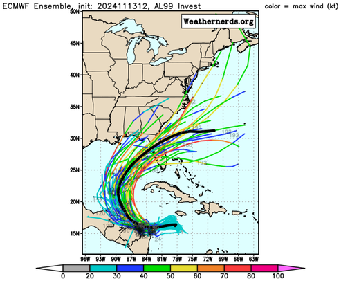
Here is what the ECMWF (European Centre for Medium-Range Weather Forecasts) is forecasting for this system:
Here is what the National Hurricane Center has to say, currently, about this system/
[T]he system is expected to become a tropical storm within the next day or so and it is likely to bring tropical storm or hurricane conditions to land areas within the next 36 to 48 hours. Therefore, the National Hurricane Center is initiating Potential Tropical Cyclone advisories for this disturbance. The initial motion is more uncertain than normal since the system is still in the formative stage, but the best estimate is westward at about 5 kt.
Once the system becomes better organized and develops an inner core, the environmental conditions appear favorable for strengthening. Thus, the NHC forecast shows strengthening while the system moves into the western Caribbean sea.
The system is forecast to approach Belize and the Yucatan Peninsula of Mexico at or near hurricane strength by early next week where there is a risk of dangerous storm surge and damaging winds.
It is too soon to determine what impacts the system could bring to portions of the eastern Gulf of Mexico, including Florida, the Florida Keys, and Cuba during the middle portion of next week. Residents in these areas should regularly monitor updates to the forecast.
NOAA/NHC
Watching.
/fl