
Irma
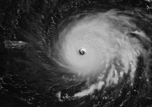
Hurricane Irma as seen in moonlight by the VIIRS instrument on the Suomi satellite at approximately 3 am EDT Wednesday, September 6, 2017. Barbuda was in the southeastern eyewall of Irma at this time. Puerto Rico is visible at the left of the image. Image credit: NASA.
Below is live footage of Hurricane Irma destroying a camera located in St Maarten. I doubt that we will see many TV reporters doing their live 'storm-cast' standing out in this stuff:
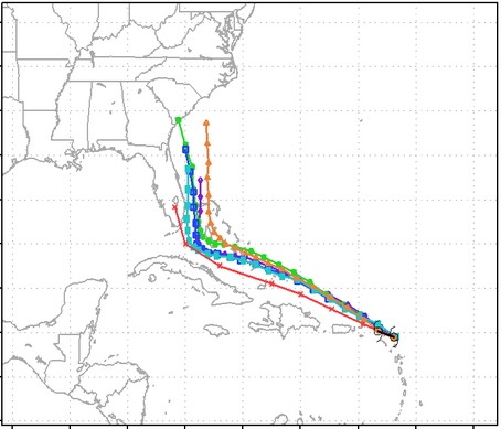
Forecast Tracking models for 09/06/17.
This will likely be the strongest storm to hit the Florida Keys since the 1935 Labor Day storm that wound up killing several hundred people.
/fl