
Update on Fred
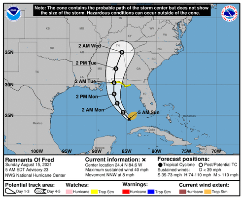
The latest forecast shows the storm’s predicted track moved east to the vicinity of Pensacola, and it could move even further east before coming ashore sometime early Tuesday morning. The intensity forecast still shows the storm's winds to be 45 knots with gusts to 55 knots at landfall.
UPDATE: The 1000CDT updated track forecast now shows the center of the storm coming ashore at 086.5’W which would put it in the Destin area. Fred is now expected to make landfall sometime Monday afternoon or evening. The intensity forecast for landfall remains steady at 45 knots with gusts to 50 knots.
Watching…
/fl