
One to Watch
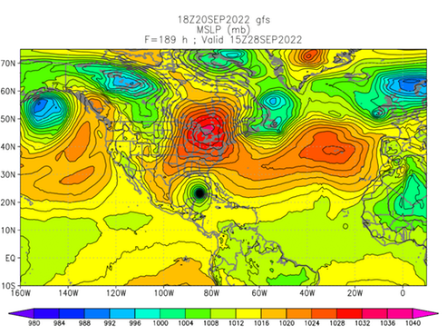
There is a "tropical wave” (“98L") disturbance presently located near 10N, 55W, with an 80% chance of development, that the GFS modeling predicts will be entering the Gulf of Mexico between Cuba and Mexico in about 8 days.
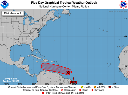
It’s still a long way off, but the intensity models indicate that system has the potential for Category 2 or 3 hurricane status—or even higher by next week at this time.
Not good news...
Watching closely.
/fl