
Storm 93
It looks like this system is headed our way; predicted to be somewhere near Pensacola at mid-day Thursday (12OCT) with a pressure of around 1005 millibars. Some of the models show an offshore track paralleling the coast. We’ll see.
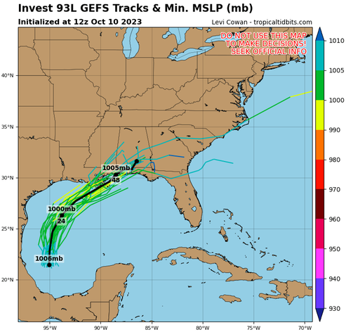
Southwestern Gulf of Mexico (AL93): Updated: Showers and thunderstorms remain disorganized this afternoon in association with a broad area of low pressure located over the southwestern Gulf of Mexico. Data from an Air Force Reserve Reconnaissance aircraft investigating the system has so far found the circulation remains elongated and not well-defined, with maximum sustained winds of only 20-25 mph. Based on the current structure, additional development is becoming unlikely before the system merges with a developing frontal boundary over the western Gulf of Mexico on Wednesday.
Watching.
UPDATE: 11 Oct PM This system has weakened to mostly rain; the peak effect for our area is forecast to be rain and NE wind of 23mph, with gusts as high as 38mph around 2200 tonight,
/fl