
And Now: The Surge
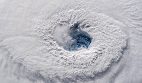
[O]n Wednesday evening the hurricane had a less impressive unsymmetric appearance, with the eye filled with low-level clouds. The south side of the storm had little upper-level outflow, and there was likely some wind shear affecting the storm there.
The most concerning forecast continued to be from our top model for forecasting hurricanes, the European model, whose 12Z Friday run predicted that Florence’s stall would occur just offshore of the NC/SC border, with the hurricane then traversing the northern half of the coast of South Carolina just offshore, until making landfall near Charleston. This would allow Florence to keep its eye over water, greatly increasing the amount of rain it can generate, and would subject a very long stretch of coast to high winds and a destructive storm surge. Our other top models--the GFS, HWRF, UKMET, and HMON--all predicted Florence would move ashore near the NC/SC border, then turn to the west-southwest over land. On this track, Florence would still keep a large part of its circulation over water and dump extreme rains, but would not bring a devastating storm surge and hurricane-force winds to a long stretch of coast. By Monday, Florence is expected to be headed due west.
The greatest damage from Florence is likely to come from its rains, which may cause catastrophic flooding along a long swath of its track. The storm’s second greatest threat is storm surge; Florence’s wind field has put a large region of ocean into motion, which is already increasing water levels along the coast of North and South Carolina. As of 6 pm EDT Wednesday, the highest surge along the coast of the Carolinas that had occurred was 1.8 feet at Oyster Landing, SC (see the SURGEDAT storm surge update page for live storm surge values along the path of Florence).
/ WU