
Florence Update
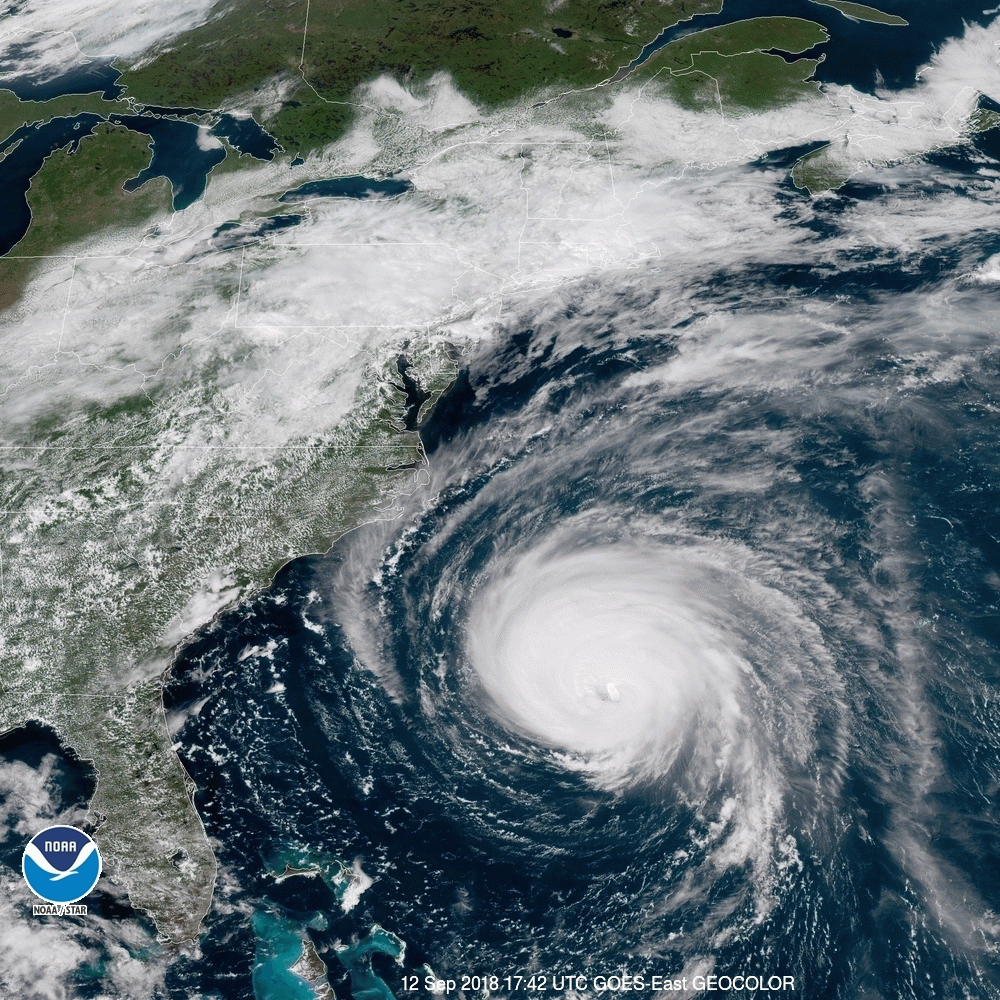
The path of Hurricane Florence is still set squarely on the Carolinas, but the storm was downgraded to a Category 3 and remained that way as of 5 p.m. Wednesday.
But Florence was still almost a Category 4, with winds in the 120 mph range, the NHC said as of 5 p.m. A Category 3 is 111 to 129 mph. A category 4 is 130 to 156 mph.
Changes in the storm’s strength are possible through Thursday morning, according to the National Hurricane Center (NHC), and though the storm may slowly weaken late Thursday, Florence “is still forecast to be an extremely dangerous major hurricane” when it nears the coast.
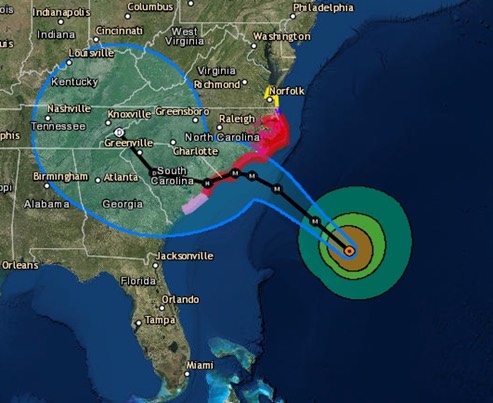
The storm’s track also changed early Wednesday morning as Florence slowed and shifted south and west, encompassing more of South Carolina and western North Carolina.
The “probable” forecast path for Florence as of 5 p.m. Wednesday showed the storm shifting farther toward the southern North Carolina coast and the northern half of the South Carolina coast, with the forecast cone stretching into Georgia, western North Carolina and Tennessee, according to the NHC.
Once it makes landfall, the current forecast path shows the storm making a turn even farther south toward southern South Carolina and Georgia around Saturday morning.
Meanwhile, the National Hurricane Center was reporting waves within the storm are 83 feet high, and rainfall projections for coastal North Carolina are in the 20 to 40 inch range.
The first projections of tornadoes have also been released, with the National Hurricane Center reporting “tornadoes are possible in eastern North Carolina beginning late Thursday morning.”
/NOAA