
Laura (Update)
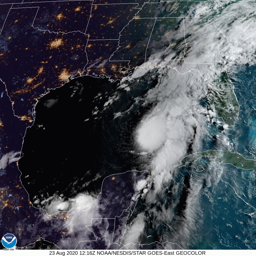
This is interesting. Hurricane Marco is already in the Gulf of Mexico, running ahead of Laura, but has not developed an eye—yet.
Bringing up the rear, Laura is now forecast to make landfall near the TX/LA border.
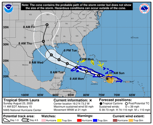
Although the center of Laura was been difficult to track while it passed over Hispaniola, the estimated motion is west-northwestward at about 18 kt. A strong deep-layer ridge over the western Atlantic should continue to steer Laura west-northwestward for the next couple of days. The track guidance has continued to nudge southward during the first 36 hours and the official forecast has been adjusted accordingly, taking the storm closer to the southern coast of Cuba. After that time, the ridge is forecast to build westward over the eastern Gulf of Mexico. This pattern should allow Laura to maintain a west-northwestward motion until it approaches the central Gulf, where a northwestward motion is expected to begin as the storm nears the western periphery of the ridge. The dynamical models have trended toward stronger ridging over the eastern Gulf, resulting in a westward shift in the guidance. The NHC track forecast has been moved westward at 72-96 hours, and lies between the GFS and ECMWF solutions. Users are reminded to not to focus on the exact details of the track forecast at the longer range as future adjustments will likely be required, and storm hazards will extend far from the center.
NOAA-NHC