
Laura (Update)
Laura crosses the Western end of Cuba, and gains strength as it heads for the U.S. Gulf Coast.
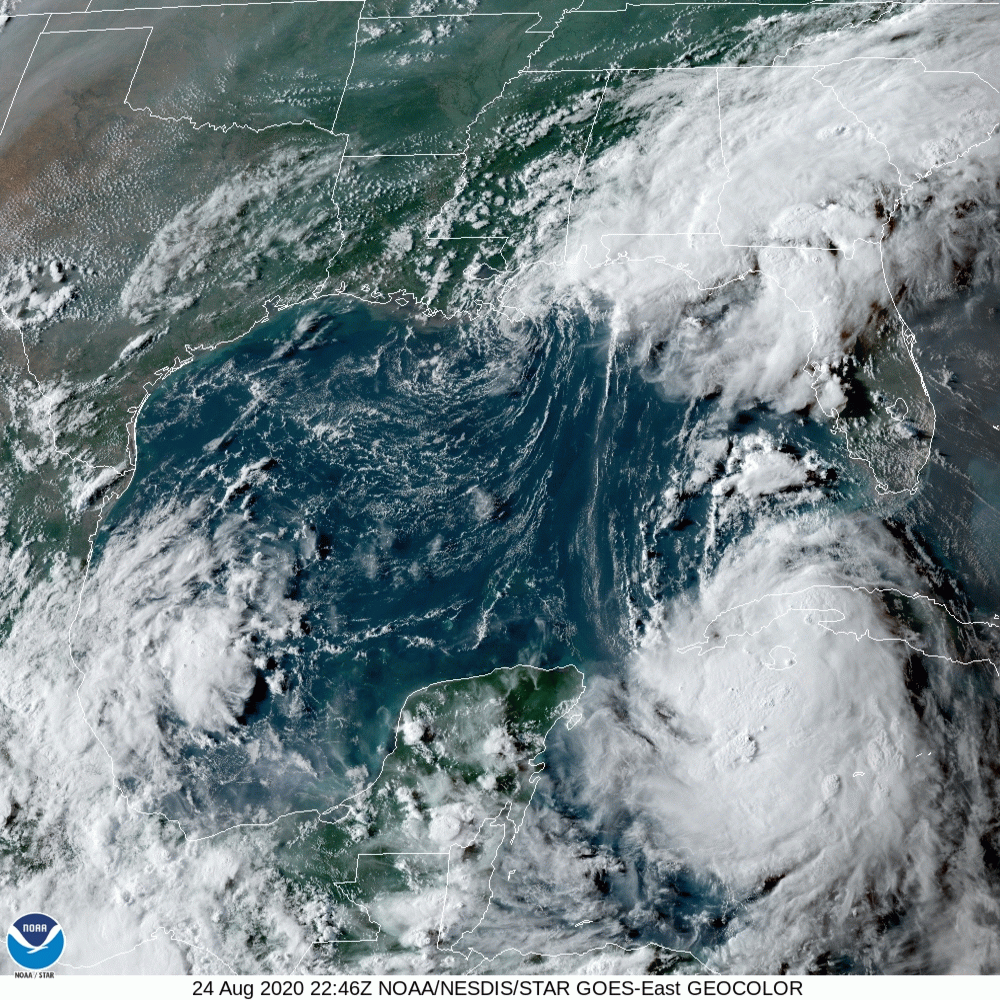
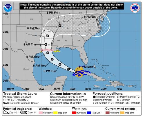
The storm is starting to pull away from the western portion of Cuba, and it should be over the warm Gulf of Mexico waters for about 2 days. Since Laura will have a notable amount of time over waters with high oceanic heat while moving through a low wind shear and high moisture air mass, significant strengthening seems quite likely until the storm makes landfall. The intensity models all show Laura making landfall as a hurricane, but there are differences on exactly how strong it will be. The NHC intensity forecast continues to stay near the consensus aids, which usually perform best, and Laura could be near major hurricane strengthen when it reaches the coast.
This does not look good!
/fl