
Laura (Update)
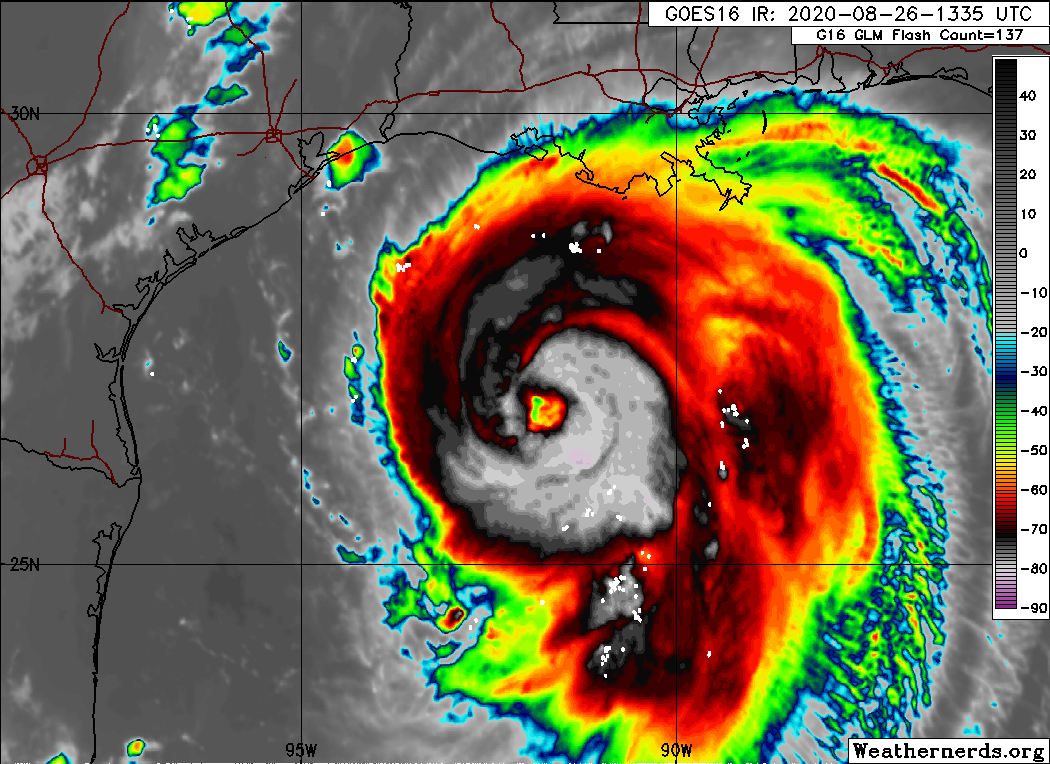
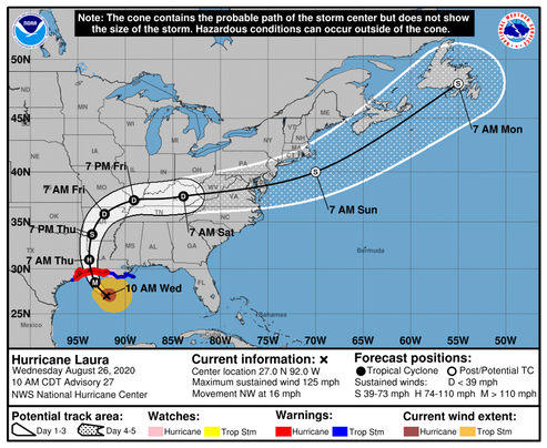
Laura has become a very powerful hurricane this morning. The satellite presentation has continued to improve with the eye becoming better defined, and cloud tops colder than -70C in the surrounding ring of deep convection. Both NOAA and Air Force hurricane hunter aircraft have provided valuable data this morning. The NOAA P-3 aircraft reported a peak flight-level wind of 125 kt at 8000 ft, and a peak SFMR wind of 104 kt, while the Air Force crew has observed peak 700-mb flight-level winds of 121 kt and peak SFMR winds of 104 kt. The lastest minimum pressure estimated from aircraft data is 956 mb, indicating a pressure drop of 27 mb over the past 12 hours. Based on the aircraft data, the initial wind speed was increased to 100 kt on the 1200 UTC intermediate advisory, and is now set at 110 kt based on the latest flight-level and SFMR winds. Laura is likely to continue strengthening today while it moves over warm waters of the northwestern Gulf of Mexico and the vertical wind shear remains low. Laura's intensity could level-off by this evening due to the possibility of an eyewall replacement cycle and the expected increase in shear around the time of landfall. Even if the rate of strengthening eases, Laura is expected to be an extremely powerful category 4 hurricane when it reaches the northwestern Gulf coast. After landfall, rapid weakening will occur, but Laura will bring a swath of damaging winds well inland over western Louisiana and eastern Texas.
/NOAA